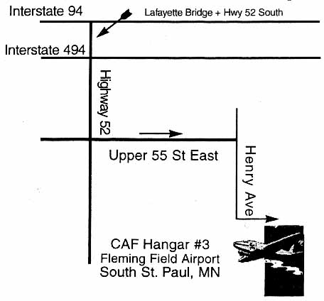
From Interstate 494, at the southeast corner of the Twin Cities, exit south on Hwy 52, 7th St., or 5th St. Go south to Upper 55th Street or South Street. Turn left and go east until the road dead-ends at Henry Ave, then turn right (south) and drive into the airport parking area. The hangar has been the second World War II quonset hangar on your left, the one with the label "Hangar #3" and the Commemorative Air Force Minnesota Wing logo on the outside. However, for Spring and Fall 2011, the dance will be in a different hangar across the field. Signs in the airport parking area and CAF personnel will direct you to the hangar.
| Notes: |
Upper 55th St. East becomes W. South St. when it crosses Cahill Ave. (7th St.) |
| If you are using internet-based map engines, such as MapQuest, Yahoo Maps, or Expedia, look for 60th St E at Henry Ave in South St Paul, MN, 55075. You can also look for South Saint Paul Municipal Airport. | |
| Call (651) 455-6942 for the Commemorative Air Force (formerly called the Confederate Air Force) at Fleming Field in South St. Paul. |
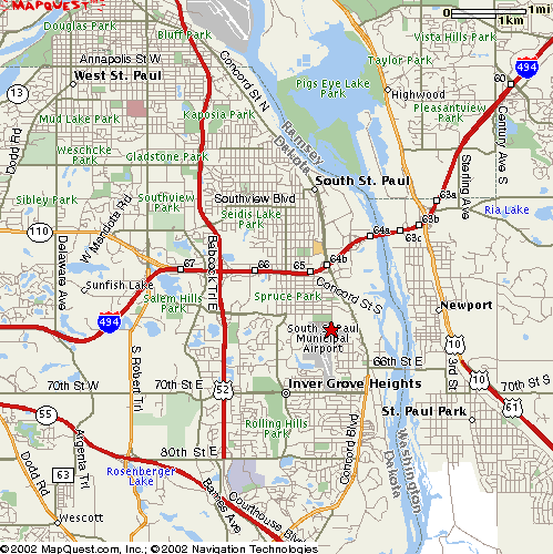
Here's a bigger picture of the southeast corner of the 494 loop. The star shows the location of the hangar dance.
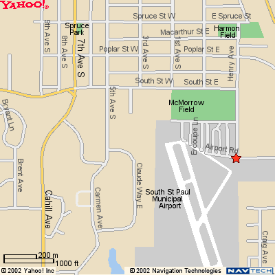
Here's some more detail near the hangar.